I was lucky enough recently to be able to spend a couple of hours steeped in the archive at Sutton Central Library, going through maps of the site where the London Cancer Hub is now based, and talking about the site with a member of the London Borough of Sutton team responsible for shepherding the London Cancer Hub site through the development process. Such a lot of interesting ideas emerged in one afternoon from talking about both the history and the future of the site. Once again I was overwhelmed with the amount that I learned and am full of questions about the implications for the evolution of the London Cancer Hub ecosystem as well as new ideas that may develop into artwork…
Site Plans
So, as I think i have probably already mentioned, the London Cancer Hub is made up of a number of different organisations or groups of organisation. The most significant of these that I have been thinking about are – in no particular order:
- The Royal Marsden Hospital (mainly in purpose-built 1950s buildings but with a very new state-of-the-art structure)
- The ICR (in brand spanking new purpose built blocks)
- The Innovation Gateway (currently inhabiting a small existing mid-century block)
- Maggie’s Cancer Centre (in one of their beautiful architecturally designed centres)
The element missing from that list is the major commercial site. The Innovation Gateway is the current incarnation of this, an incubator for small biotech, lifestyle and medical companies whose work fits well with the cancer focus of the Hub. But future plans are larger and more ambiutious, with a vision to house much larger companies (or parts thereof), big players in the medical and/or pharmaceutical world. There is a ‘preferred bidder’ to build this major development , with final contracts potentially being awarded in a few months time, depending on progress. The physical area for all the building to happen is currently essentially the demolition site of a number of old hospital buildings that were no longer useful and would have been complex and expensive, if not impossible, to adapt to this new purpose.

Discussion about this led quickly onto a conversation about land ownership. I had somehow assumed that there was a single site that formed ‘The London Cancer Hub’, owned by a single entity, but this is not the case. As i understand it post that conversation, the ICR owns its own plot; the NHS owns the plot on which the Royal Marsden stands, Maggie’s sits on the Royal Marsden site and the London Borough of Sutton has recently purchased the site for the commercial sector development, which as far as I can tell is referred to as The London Cancer Hub in itself also. This I think may be the root of some of the confusion that I’ve been feeling when talking to different people about the LCH – do we both mean the whole site encompassing everything, or do we mean the new commercial development? This adds to an existing confusion, for example, that I had during one conversation where the person i was talking to interpreted the London Cancer Hub as meaning the focus on the site during the pandemic for treating London-based cancer patients. I will be posting here again about some of this ambiguity, which feels quite important to the ongoing creation of a ‘London Cancer Hub’ ecology. However, ambiguity aside i found the way the sites come together to be fascinating, a real patchwork or mosaic of a site.
Site History
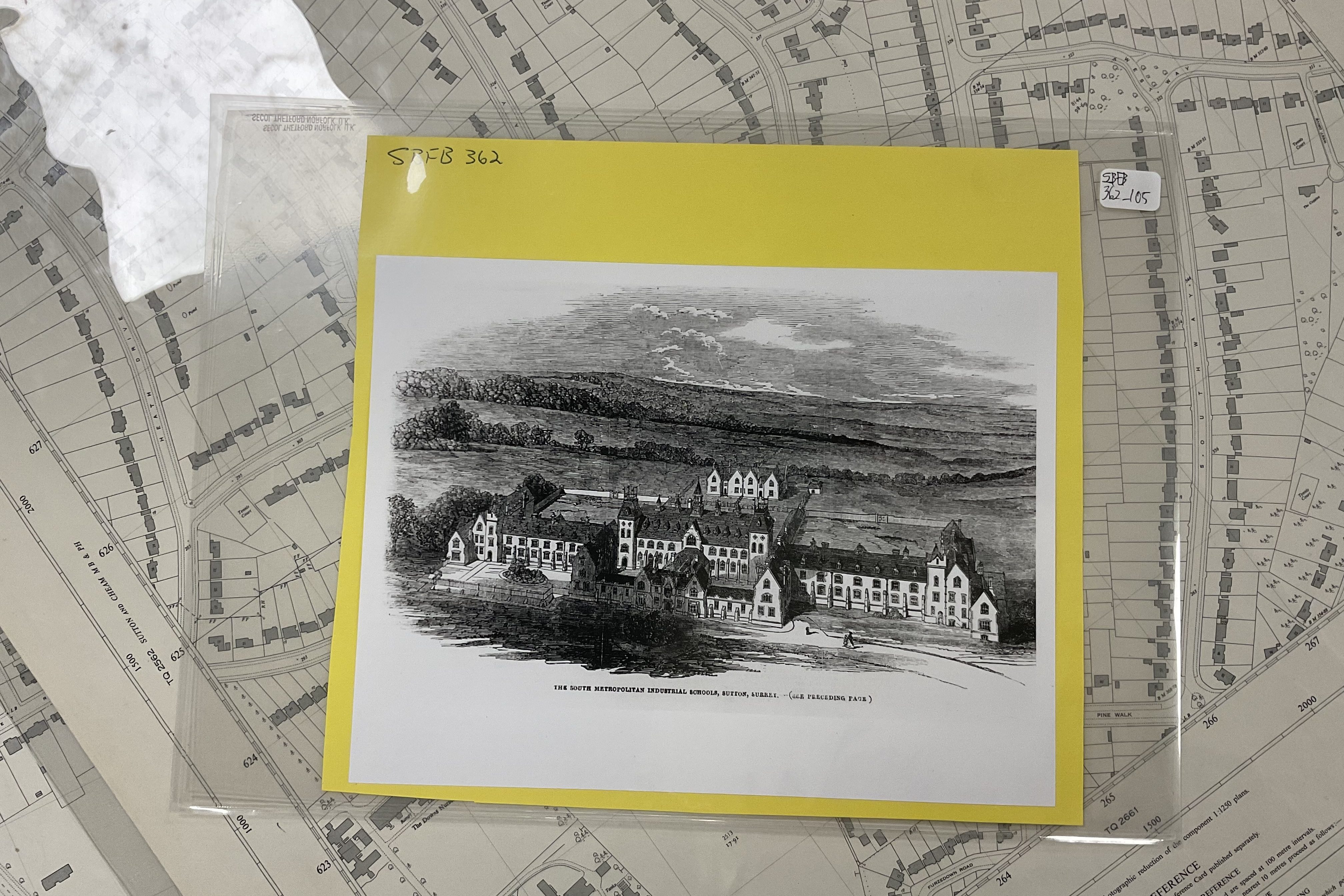
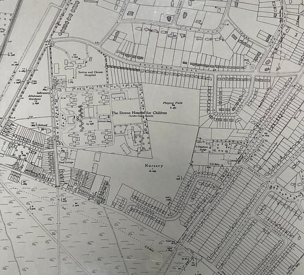
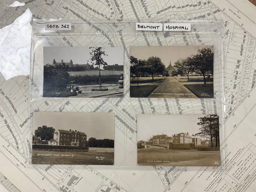
But before I get onto that, once back at the archive I had a chance to focus on the previous and historic uses of the site, which started as the South Metropolitan School for Girls in the mid 1800s.
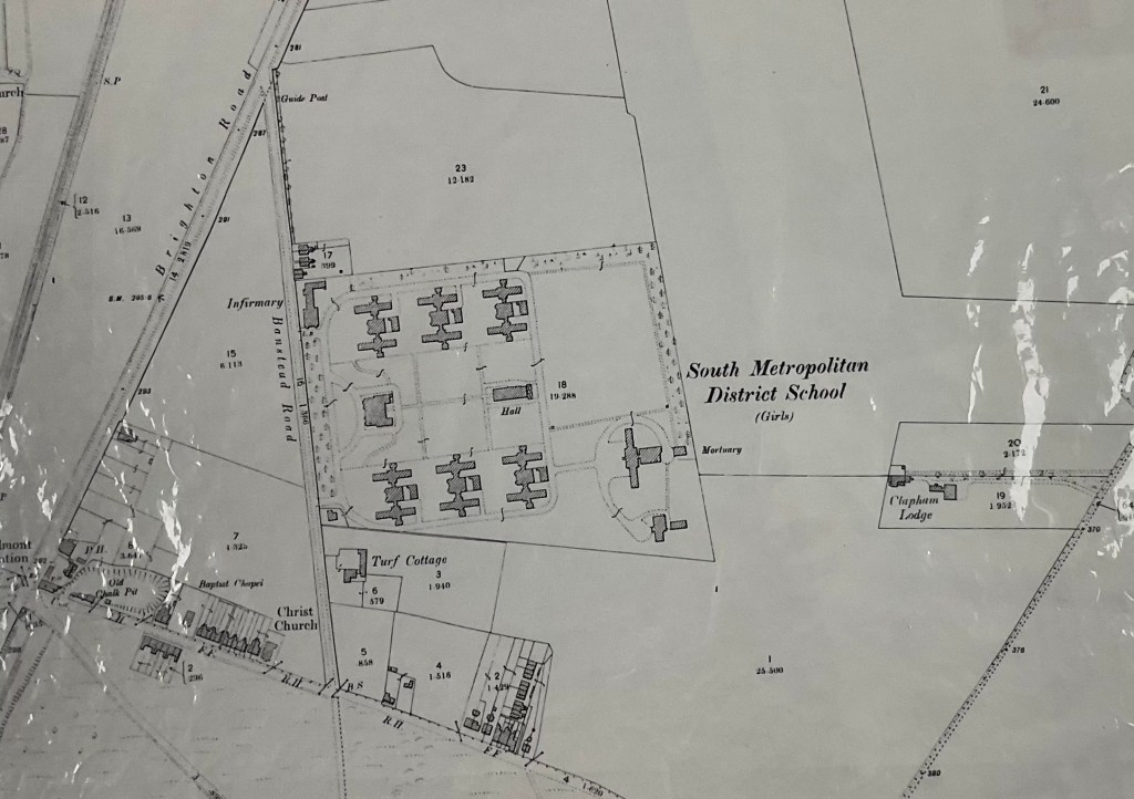
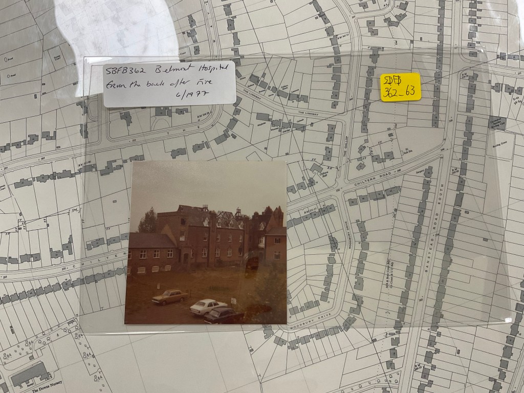
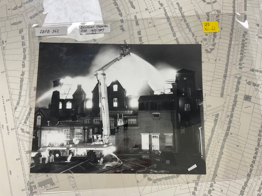
What follows is a series of images of the site over the years, thanks to the historic maps of the area, and some images of the buildings too from over the years. The building images are the ones that particularly struck me, though there were many more to choose from that might have given a more comprehensive overview of the way the buildings evolved and came together.

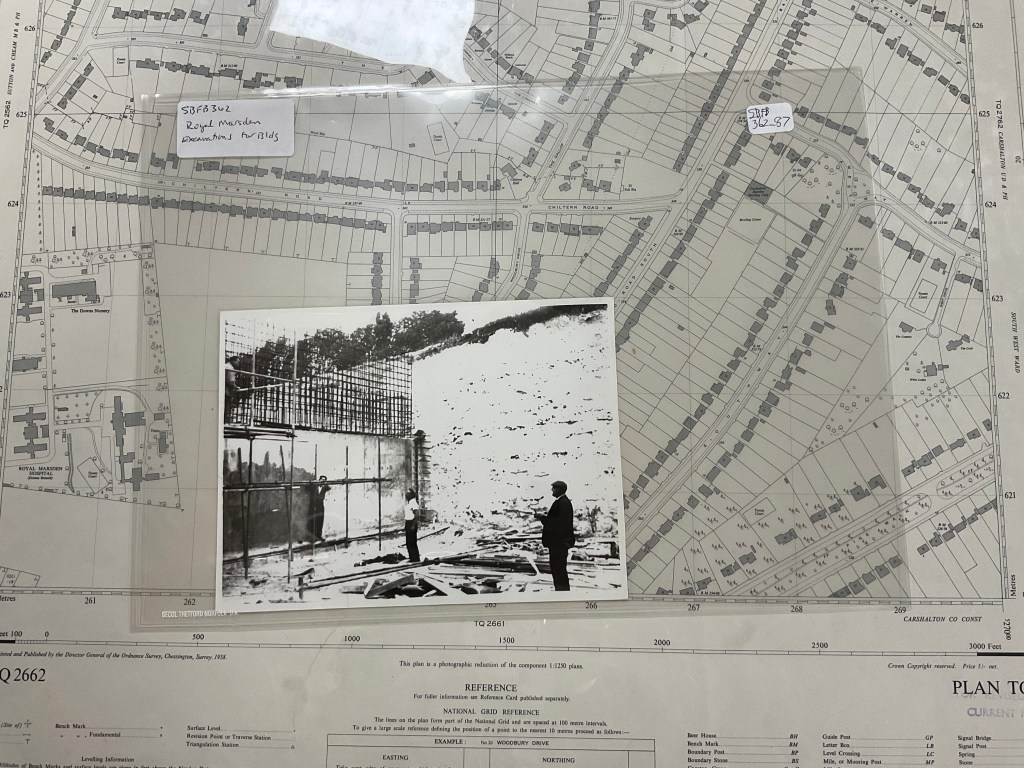

I was struck how this image is almost the same angle as the one above with the demolition barriers in place.
I also noticed as I pored through the images that there had been a lot of fires in the old hospital buildings.

I’m not sure how the history of the buildings themselves or, indeed, the fires will feed into my understanding of the ecosystem, or they will feature in my artwork, but both struck me as interesting and worth recording here… The nature of the site as a mosaic of different ownerships, though, I already know is productive food for thought.
In the meantime, thanks so much to the LBS team and the archive for sharing the maps and letting me browse through the photos. Apologies that images are not great – they were my snapshots but maybe at some point I can go back and get better pictures….
